Inertial Navigation Solutions for navies
Get more information with

Jean Lagaillarde
Product and Bid Manager
An Inertial Navigation System (INS) is at the heart of a vessel’s navigation. It provides key position and time data without having to rely on easily disrupted GNSS signals. Such a critical role requires both high-performance, and unfaltering reliability.
iXblue is the European leader in naval navigation systems and equips over 40 navies worldwide. Our wide range of sensors and systems are designed to address the requirements of the full spectrum of naval platforms, from smaller coastal and support vessels to aircraft carriers, including main surface combatants and submarines. All of our INS are maintenance and ITAR-free.
Unmatched Performance
 The performance of a fiber-optic gyroscope can be changed by altering the length and diameter of its coil, making it adaptable to a wide range of performance needs. Performance can further be increased by pushing back the technological limits of the optical components that are used within the FOG gyroscope.
Because iXblue has complete mastery over all the components that are integrated into its systems, from its own optical fiber and components, to its accelerometers and algorithms, the company can push the limits of the FOG technology to have it reach new peaks of performance.
Powered by FOG
 The FOG (Fiber-Optic Gyroscope) is the result of more than 30 years of research and development and is today considered to be the best gyroscope in the world: its performance is deemed genuinely unlimited.
Based on the Sagnac effect, FOGs are passive systems that use light to calculate motion. Rotations movements are measured by sending identical laser beams, in opposite directions, through a long fiber-optic coil.The laser beam travelling against the direction of rotation experiences a slightly shorter path delay than the other beam. Measuring the phase shift between the two beams reveals changes in orientation. Objects being free to rotate in three dimensions, iXblue’s Fiber-optic based inertial navigation systems contains three FOG gyroscopes, measuring rotations on those three different axes.
Outstanding Reliability
 Fiber-Optic Gyroscopes are truly solid-state passive systems. Indeed, the FOG technology does not involve any movement of mechanical parts causing dithers, vibrations, frictions and resulting in parts’ weariness and noise. This ensures many benefits for the user: acoustic stealth, robustness of the system (Power-on and Forget), cost-effectiveness and the lowest cost-of-ownership on the market
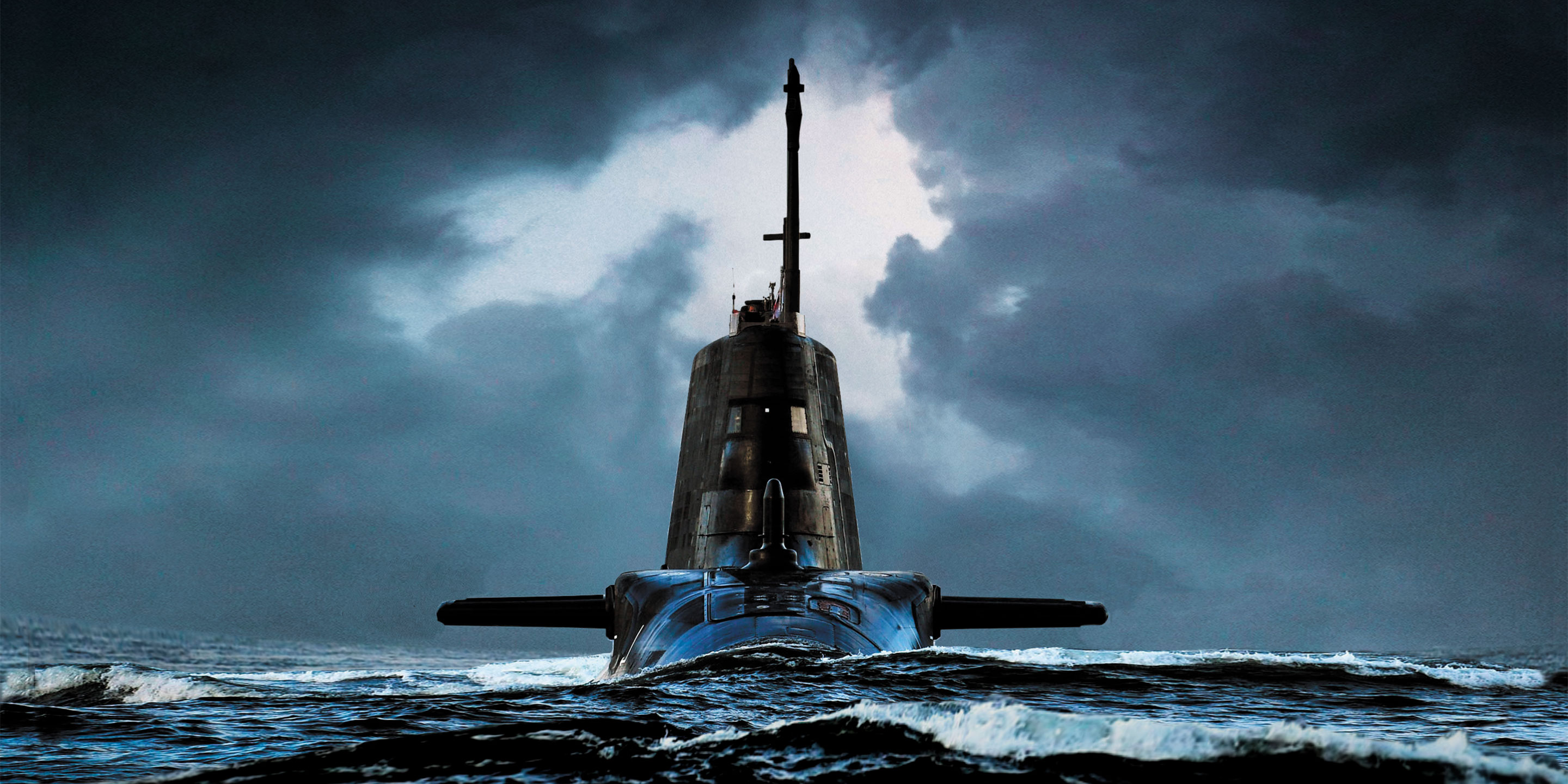
Operating as a single component and relying only on light motion, FOGs are resistant to external disruptions such as shocks, extreme temperatures, magnetism or vibrations. This is why FOGs equip systems operating in extreme environments or expecting high resistance from their sensors: satellites, strategic submarines, long-range artillery, extreme deep-water robots and vehicles.
Complete Mastery of Technology Through Vertical Integration
 iXblue has end-to-end control of its value chain, from the design work carried out in its engineering offices through to manufacturing in the company’s own production facilities. Its control over the performance of its products and its capacity to adapt are guarantees of quality and excellence.
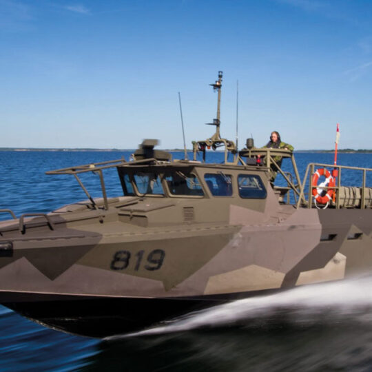
An Inertial Navigation Solution for Every Vessel
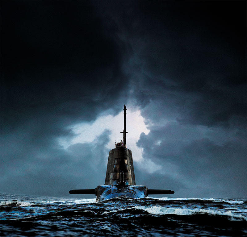
Strategic and military grade INS for warship and submarine
Phins and Marins Series form a family of state-of-the-art naval inertial navigation systems, designed to meet the demands of the navy for the highest performance INS.
Marins Series enables stealth autonomous navigation for submarines, providing very accurate heading, roll, pitch, speed and position. These products also uniquely address the need for advanced naval surface vessels, operating under severe GNSS-denied environment. Phins and Marins Series are based on iXblue FOG technology, proven for superior reliability and performance. iXblue high-performance navigation systems are chosen by world leading navies.

|

|
|

|
|

|

|
|
|---|---|---|---|---|---|---|---|
| Type | INS | INS | INS | INS | INS | INS | INS |
| Heading accuracy (seclat RMS) | 0.01° | 0.01° | 0.01° | 0.01° | 0.01° | 0.01° | 0.01° |
| Roll&Pitch accuracy (RMS) | 0.01° | 0.01° | 0.01° | 0.01° | 0.01° | 0.01° | 0.01° |
| Position accuracy no aiding, without GNSS (TRMS) | 0.6 NM/h | 1NM/12h | 1NM/24h | 1NM/72h | 1NM/96h | 1NM/120h | 1NM/360h |
| Certification IMO/IMO HSC | |||||||
| Certifications MIL STD 810 / MIL STD 461 | |||||||
| Get a Quote | Get a Quote | Get a Quote | Get a Quote | Get a Quote | Get a Quote | Get a Quote |
|
|
|
|
|
|
|
|
|
|---|---|---|---|---|---|---|---|
| Type | INS | INS | INS | INS | INS | INS | INS |
| Heading accuracy (seclat RMS) | 0.01° | 0.01° | 0.01° | 0.01° | 0.01° | 0.01° | 0.01° |
| Roll&Pitch accuracy (RMS) | 0.01° | 0.01° | 0.01° | 0.01° | 0.01° | 0.01° | 0.01° |
| Position accuracy no aiding, without GNSS (TRMS) | 0.6 NM/h | 1NM/12h | 1NM/24h | 1NM/72h | 1NM/96h | 1NM/120h | 1NM/360h |
| Certification IMO/IMO HSC | |||||||
| Certifications MIL STD 810 / MIL STD 461 | |||||||
| Get a Quote | Get a Quote | Get a Quote | Get a Quote | Get a Quote | Get a Quote | Get a Quote |
Multipurpose state-of-the-art Attitude Heading Referencing System (AHRS)
Quadrans are fully strap-down Fiber-Optic Gyrocompass (FOG) and attitude reference system.
IMO and IMO-HSC certified, they provide all the necessary data for demanding navigation and control applications at a fast rate and with precise time-stamping.
Thanks to their low weight and small size, their low power consumption and their Ethernet/serial connectivity, they can be integrated with ease on any platform.
Based on state-of-the-art Fiber-Optic Gyroscope technology, Quadrans and Octans answers to a full range of navigation needs, without any compromise on performance and without requiring any maintenance during its service life.

|

|
|
|---|---|---|
| Type | AHRS | AHRS |
| Heading accuracy (seclat RMS) | 0.15° | 0.1° |
| Roll&Pitch accuracy (RMS) | 0.1° | 0.01° |
| Position accuracy no aiding, without GNSS (TRMS) | N/A | N/A |
| Certification IMO/IMO HSC | ||
| Certifications MIL STD 810 / MIL STD 461 | ||
| Ask for Quote | Ask for Quote |
|
|
|
|
|---|---|---|
| Type | AHRS | AHRS |
| Heading accuracy (seclat RMS) | 0.15° | 0.1° |
| Roll&Pitch accuracy (RMS) | 0.1° | 0.01° |
| Position accuracy no aiding, without GNSS (TRMS) | N/A | N/A |
| Certification IMO/IMO HSC | ||
| Certifications MIL STD 810 / MIL STD 461 | ||
| Ask for Quote | Ask for Quote |
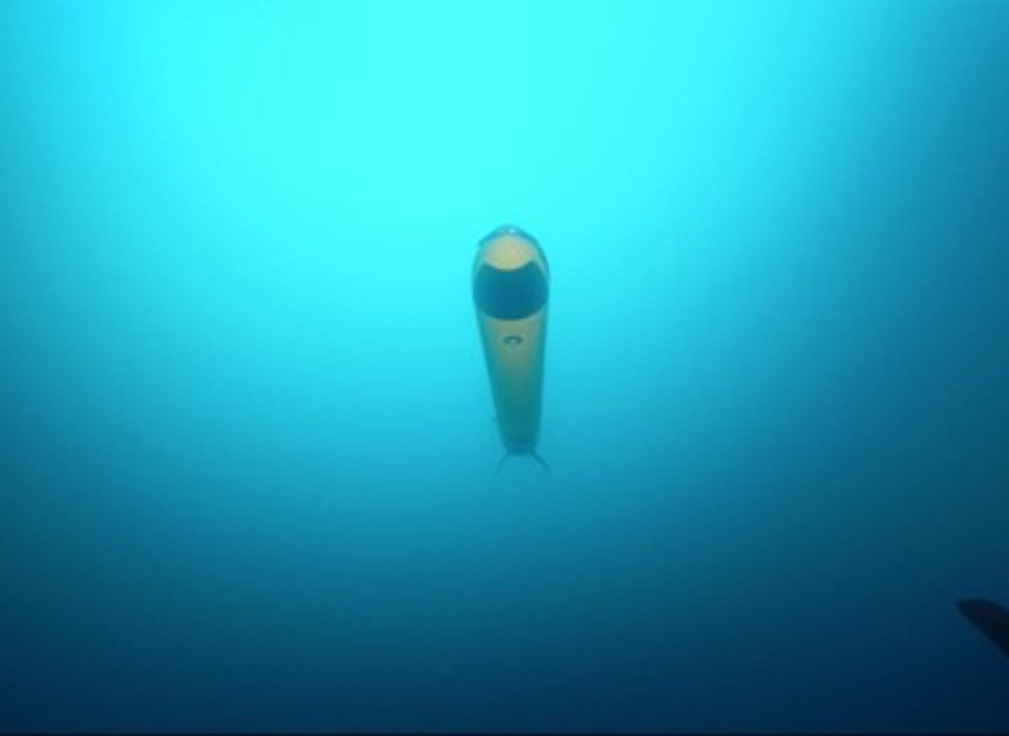
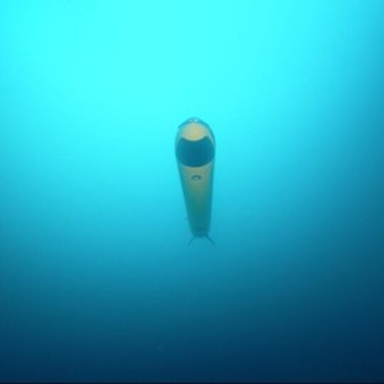
INS for Uncrewed Underwater Vehicles
Phins Compact Series is a complete range of subsea Inertial Navigation Systems (INS) specifically designed to improve accuracy and bring reliable cost-efficient navigation solutions to all Autonomous Unmanned Vehicles (AUVs). Offering a fully scalable and ITAR-free solution, it allows AUVs industry players to choose the INS the most suited to their needs, whatever the platform’s size and mission type.

|

|

|
|
|---|---|---|---|
| Heading (Deg) | 0.15 | 0.07 | 0.01 |
| Roll & pitch (Deg) | 0.05 | 0.01 | 0.01 |
| DVL-Aided performance (straight line from origin (%TD – CEP 50)* | 0.2 | 0.1 | 0.05 |
| DVL-aided performances (area survey pattern) (%TD – CEP 50)* | 0.04 | 0.02 | 0.01 |
| Power consumption (W) | 12 | 12 | 20 |
| Get a Quote | Get a Quote | Get a Quote |
|
|
|
|
|
|---|---|---|---|
| Heading (Deg) | 0.15 | 0.07 | 0.01 |
| Roll & pitch (Deg) | 0.05 | 0.01 | 0.01 |
| DVL-Aided performance (straight line from origin (%TD – CEP 50)* | 0.2 | 0.1 | 0.05 |
| DVL-aided performances (area survey pattern) (%TD – CEP 50)* | 0.04 | 0.02 | 0.01 |
| Power consumption (W) | 12 | 12 | 20 |
| Get a Quote | Get a Quote | Get a Quote |

|

|

|

|
|
|---|---|---|---|---|
| Ethernet | 2 | 6 | 24 | 48 |
| I/O Modules | 2 modules | 6 modules | 11 modules | 22 modules |
| Cabling | Cable glands | Connectors | Cable glands | Cable glands |
| Front screen | External | External | External | Optional |
| Time clock | External | External | Optional | Optional |
| UPS | External | External | Optional | Included |
| Dimensions (H x W x D) in mm | 164 x 239 x 336 | 250x400x400 | 700x600x600 | 1400x600x600 |
| Power supply (default) | 24 VDC | 24 VDC | 115VAC 240VAC | 115VAC 240VAC |
| Get a Quote | Get a Quote |
|
|
|
|
|
|
|---|---|---|---|---|
| Ethernet | 2 | 6 | 24 | 48 |
| I/O Modules | 2 modules | 6 modules | 11 modules | 22 modules |
| Cabling | Cable glands | Connectors | Cable glands | Cable glands |
| Front screen | External | External | External | Optional |
| Time clock | External | External | Optional | Optional |
| UPS | External | External | Optional | Included |
| Dimensions (H x W x D) in mm | 164 x 239 x 336 | 250x400x400 | 700x600x600 | 1400x600x600 |
| Power supply (default) | 24 VDC | 24 VDC | 115VAC 240VAC | 115VAC 240VAC |
| Get a Quote | Get a Quote |
More infos
-
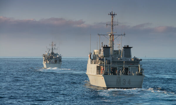
 12 Sep 2023
- Defense
Exail delivers navigation systems to the Spanish Navy Turia M34 minehunter
Exail, a global leader in naval navigation, together with its Spanish representative GRAFINTA, have successfully delivered navigation systems to the Spanish Navy to replace the…Learn more -

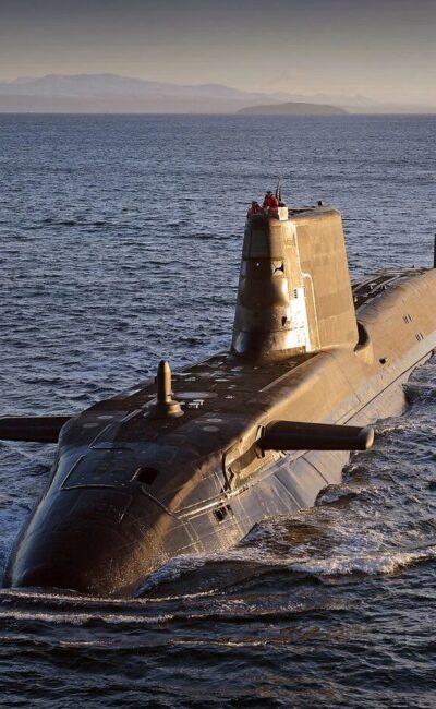
- Defense
Enhancing Royal Navy’s Astute-class submarines’ navigation
As the largest and most powerful attack submarines operated by the Royal Navy, the Astute-class play a critical role in maintaining the UK’s undersea dominance….Learn more -
- Defense
SENIN: Empowering the French Navy’s navigation for two decades
Learn more