- Maritime
High accuracy subsea positioning for scientific mission off the coast of Columbia
iXblue recently took part in a scientific mission to study marine ecosystems around the Malpelo Island, off the coast of Columbia. This mission was part of a three-year circumnavigation of the world’s oceans and seas to study the overexploitation of marine resources, pollution, ocean warming and acidification, as well as the disappearance of marine species and coral reefs.
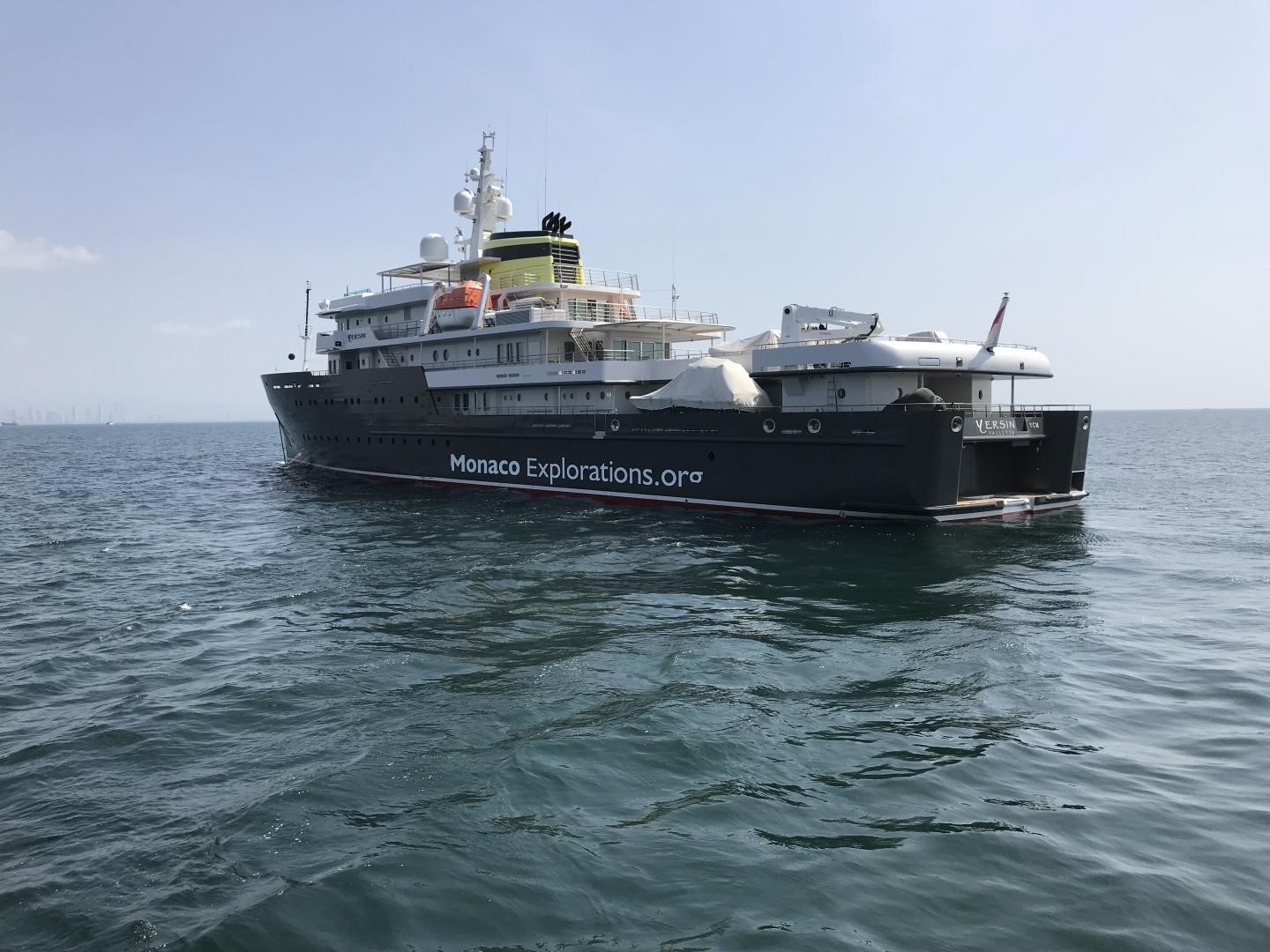
Onboard the Yersin, a vessel turned into a scientific boat by Monaco Explorations, iXblue’s USBL (Ultra Short Base Line) positioning system, Gaps, provided accurate positioning of the ROV (Remotely Operated Vehicle) used to sample environmental DNA and film the seabed at depths reaching up to 1,000 meters during the three-week mission.
For this mission, Gaps was installed on a pole lowered into the water thanks to the crane of the vessel. This allowed the easy use of Gaps that did not need to be mounted on the vessel itself, an operation that would have proven challenging on this type of ship. Such a use of iXblue’s USBL antenna was made possible thanks the INS (Inertial Navigation System) directly integrated within Gaps, and that provided permanent and accurate monitoring of the antenna’s motion.
Gaps thus ensured accurate positioning of the ROV, whatever its conditions of use (vertical or horizontal positioning) and offered a nominal range of 4,000 meters and a positioning precision of 1 meter for a slant range of 1,000 meters.
Recent updates made to Gaps opened-up the way to new functional capabilities such as a bidirectional acoustic communication link between the vessel and the underwater vehicle thanks to the telemetry function. In addition to its positioning functionality, Gaps thus also acts as an acoustic modem, enabling various other features (recalibrating an INS while in position, retrieving sensors data, sending control command to a subsea vehicle, retrieving the subsea vehicle information). Gaps offers a robust acoustic communication link with a data transfer speed that can reach up to 500 bits/s even in harsh and noisy environments.
Gaps thus offers both the positioning and the telemetry functionality within a single device, making it possible to save space and energy on the underwater vehicle which only has to use a single beacon. This makes the management of acoustic resources much more straightforward as the transmissions sequencing of positioning and telemetry signals are controlled by a single device, eliminating risks of interference.
Adopted by over 120 companies, institutes and navies worldwide, iXblue’s flagship subsea positioning system, Gaps, rapidly established itself as the new standard product for operations requiring the precise positioning of an underwater vehicle. It is now used in various applications such as scientific missions, subsea construction, offshore energy exploitation or deep see mining.


