Engineering the future of train localization within the LOC4RAIL project

# #

The LOC4RAIL project is aimed at developing an on-board solution for accurate, safe and continuous train tracking, using a combination of inertial, GNSS and cartographic measurements. And this, without the need for heavy infrastructure along the tracks. This project, supported by ADEME, the French Agency for Ecological Transition, and led by a consortium that includes iXblue, SNCF, GEOFLEX and CNES, should accelerate the deployment of ERTMS (European Rail Traffic Management System). Beyond that, related effects are expected: better customer information, traffic management, driving optimization (acceleration/braking) for lower consumption, etc.

iXblue’s research team involved in the LOC4RAIL project.

Searching for a breakthrough solution for a more sustainable and passenger-friendly railway management

With the twofold objective of responding to the increase in user demand and promoting the attractiveness of rail, beset with many problems in recent years, the SNCF was keen to explore new and innovative solutions to increase the performance and optimize the capacity of the rail system, starting with the precise localization of trains.

Today, the safe localization of trains is based on track circuits or axle counters, which delimit blocks of fixed size, in which trains are located. Only one train is currently authorized to run per block. A system of beacons placed along the tracks every 1500 meters, combined with on-board odometry, allow the train to be located from the last beacon detected. Thanks to this whole infrastructure consisting of markers and track circuits, train spacing is guaranteed and traffic safety is ensured.

However, this localization system is not suitable for rail traffic increasing. It requires a significant distance between trains running on the same track, it is very heavy to operate, resulting in high and recurring maintenance and installation costs, and causes major interoperability problems.

#

Inertial technology to prevent the need for physical track equipment

To be fully exempt from the need of track infrastructure dedicated to localization, iXblue has proposed within the LOC4RAIL project, in partnership with Geoflex, an operator of new augmented GNSS services, a new hybrid localization solution resulting from the fusion of three data sources: the Atlans R7 INS, the Geoflex augmented GPS and track mapping.

A prototype of the iXblue Atlans R7 geolocation rack installed in a test train.

Through information redundancy, this hybrid inertial solution allows a more accurate and safe localization of trains. It is not subject to weather conditions and minimizes rail track maintenance costs, as it no longer requires the use of sensors, beacons, track circuits and odometers.

“We have the potential to have the SNCF save billions of euros per year. The GPS infrastructure is already in place, and establishing reliable mapping and equipping trains with INS should be much more economical for the SNCF.” says Stéphane Meyer, Referent for the Navigation Systems division.

3 years of testing

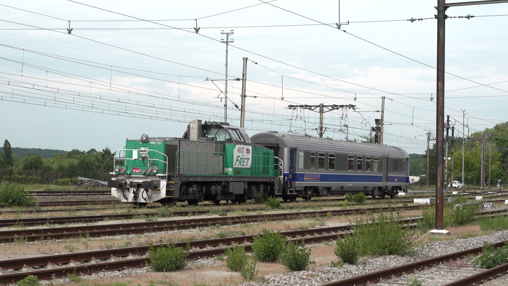
Started in September 2019, LOC4RAIL is a 3-year project, relying on the circulation of several trains equipped with prototypes of this new localization system, all around France. It involves iXblue, Geoflex and the SNCF Research and Development teams.

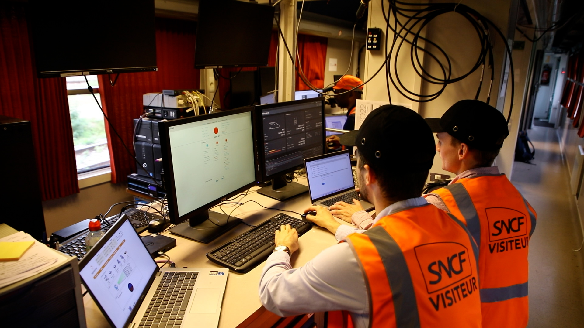
The first phase of the project consists of collecting all the use cases and writing the project’s detailed specifications as well as the system’s technical specifications. During this phase, the project team also set up several prototypes of localization systems based on existing bricks in order to record a maximum amount of rail trajectory data in various environments (lines, vehicles). The second step is to analyze these data to create and refine the fusion and inertial navigation algorithms, GNSS augmentation, and the mapping. Finally, the last part of the project plans to validate these performances in a real time version of the localization system.

Test train used in the Loc4Rail project.

Findings and prospects for further applications

The work carried out by iXblue and Geoflex helps the SNCF to accelerate its transformation and its digitalization by providing state-of-the-art know-how. In addition to being a forerunner, this new localization system provides undeniable benefits from an economic, social and environmental standpoint. Furthermore, the LOC4RAIL project also enables the preparation of the certification stages of the marketable version of this system as well as to contribute to the European standardization work (ERTMS).

  • Innovation :

Designing and demonstrating a hybrid train-internal location system combining high-performance inertial systems, augmented GNSS PPP available worldwide, a mapping system powered by the location system itself, and optimal coupling of the whole system guaranteeing the safety of the position provided.

  • Economic & social:

Offering a solution that would drastically reduce the costs of creating and maintaining railway lines, especially fine service lines of the territory and international lines, by largely simplifying the materials currently used for signaling and locating by trains tracks.

  • Environment:

Reducing the environmental footprint of the signal system. Reducing the cost to consumers in order to promote rail as an environmentally friendly and affordable mode of transportation.

  • ERTMS:

Contributing to the definition of the next ERTMS railway standards to make this system interoperable across all European countries. Some inertial, augmented GNSS and mapping couplings could also be applied by extension to other fields (autonomous vehicle, offshore, mining vehicles, etc.).

Download the LOC4RAIL project summary

Project summary by LOC4RAIL partners

(333 KB)
Download

Project summary by ADEME

(457 KB)
Download
Download all files