Great success for Canopus systems deployed in Sicily for the Focus Project
![]()
In this project a 6-km long fiber-optic cable crossing the fault at 4 different places and connected to the existing TSS Nemo Observatory has been deployed, together with an array of 8 iXblue Canopus transponders located across the fault to compare and qualify with this BOTDR measurements.
In this project a 6-km long fiber-optic cable crossing the fault at 4 different places and connected to the existing TSS Nemo Observatory has been deployed, together with an array of 8 iXblue Canopus transponders located across the fault to compare and qualify with this BOTDR measurements.
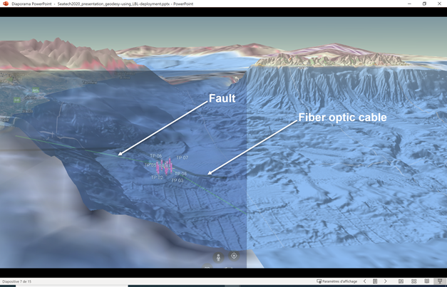
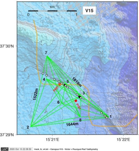
Right: 6 Km fiber-optic cable (orange) deployed and crossing the fault at 4 different places. In green, the network of transponders on the seabed from 1800 up to 1900 m deep, their inclination and position has been verified by ROV Victor.
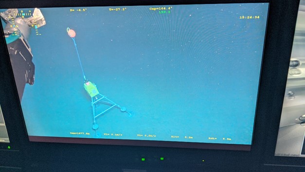
The deployment took place in the second week of Oct 2020, from the IFREMER Research Vessel Pourquoi Pas with the help of ROV Victor. iXblue support engineer Gregor Jamieson was onboard to assist during preparation and deployment. The communication with beacons was excellent, direct measurements (checking) features a repeatability of 2 µsec.
The full transponders array will accumulate relative distances between each other as well as environmental parameters over a period of 3 to 5 years, with periodic inspections and data download using the embedded transponders’ acoustic modem.
Next step of the mission will be in June 2021 for the first data query campaign.
ERC-FOCUS project:
The FOCUS project is funded by the ERC (European Research Councill) and managed by Marc Andre Gutscher et Jean Yves Royer from the IUEM (Institut Universitaire Europeen de la Mer) ->> More info : https://www-iuem.univ-brest.fr/lgo/les-chantiers/erc-focus/
Experiment of Seafloor Geodesy with Canopus : https://www-iuem.univ-brest.fr/lgo/wp-content/uploads/2019/08/20190802_geodesea_EN.pdf
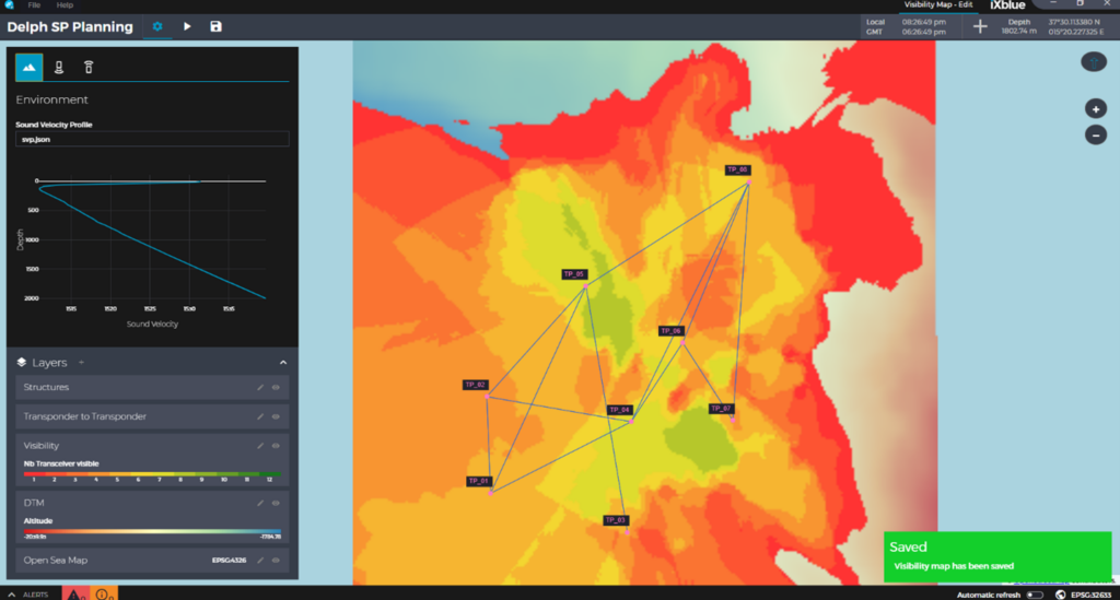
Canopus Transponders
Enhancing iXblue’s offer in subsea positioning solutions, the Canopus LBL transponder was developed in tight collaboration with major scientific partners. Easy to deploy and to use thanks to its user-friendly MMI (Man-Machine Interface), it is especially suited for scientific and industrial applications that require high autonomy, instrumentation, repeatability and accuracy.
More info HERE


