- Maritime
Cost-effective multi-sensor survey for increased safety of navigation in the south pacific
Back in 2018, the marine surveys teams of iXblue conducted one of the largest multi-sensor survey projects in the world. Making use of Satellite Derived Bathymetry, Airborne Lidar Bathymetry and iXblue’s Unmanned Surface Vessel, DriX, fitted with a Multibeam Echosounder, this project saw the charting of over 5,300nm in South West Pacific waters around the Tongan and Niue Islands.
The survey, funded by the New Zealand government, was part of a larger maritime project named Pacific Regional Navigational Initiative (PRNI). The aim of this program being to increase navigation safety in the South Pacific, a region of the world that is poorly mapped with many charts still displaying depths in fathoms and containing data that was collected with lead line and positioned with sextants.
With over 100,000 line miles surveyed worldwide, iXblue is considered one of the leading survey contractors for high resolution seafloor surveys in the Australasian region.
The company was thus contacted by Land Information New Zealand (LINZ), a government agency responsible for hydrographic survey work around New Zealand and the South West Pacific and that produces nautical charts that are relied upon by commercial and recreational mariners for safe navigation in the region. “Despite being heavily serviced by ships, the South Pacific region remains very poorly charted. This poses a serious threat from a navigational and environmental safety perspective” explains David Donohue, Director of iXblue Sea Operations division in Australia. “This is why LINZ sought to improve the quality of nautical charting in this region. Due to the extensive area in need of modern survey and charting, and a relatively small budget, LINZ needed a clever, multi-sensor approach to yield maximum return on investment with the project. LINZ thus decided to undertake a phased approach over the course of 12 months, using a variety of survey technologies including Satellite Derived Bathymetry (SDB), Airborne Laser bathymetry (ALB) and Multibeam bathymetry using iXblue’s USV.”
A new multi-sensor approach for survey work
The introduction of Multibeam Echosounders (MBES) over 20 years ago, revolutionized safety of Navigation surveys by allowing surveyors to obtain full bathymetric coverage over the entire seabed, which was not previously possible with single beam echosounders and side scan sonars. However, MBES surveys, requiring the use of large vessels, are slow and expensive to conduct. Which is particularly true for shallow water areas.
Faster and cheaper methods for collecting bathymetry have been developed and now include the use of laser scanners mounted onto aircraft as well as the use of satellite imagery. The use of SDB and ALB is particularly effective in areas where water clarity is high – such as in the SW Pacific. However, neither technology can meet the required feature detection requirements in depths greater than 20m. Accordingly, vessel mounted MBES systems are required for surveys in depths greater than 20m.
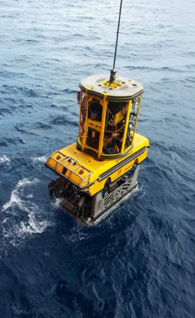
“We quickly realized that no satisfactory solution existed to bring down the cost for these surveys and decided that we needed to manufacture our own asset that would be a game changer for the survey market” continues David. “Our team of marine survey specialists worked closely with our shipyard in France to design and manufacture a dedicated and specialist survey vessel that could be deployed from a mothership – a force multiplier if you will. This is how we came up with DriX, an 8 meter-long USV with exceptional seakeeping qualities and unrivaled sensor stability. Our teams first used it to conduct the Tonga Islands mission for LINZ and it truly proved to be an efficient, cost-effective and safe solution for large area and long duration surveys.”
Satellite Derived Bathymetry
The PRNI Project began in early 2018 with German firm EOMAP, iXblue’s partner for this mission, completing one of the largest Satellite Derived Bathymetry (SDB) surveys ever undertaken. Full topographic coverage and shallow bathymetry over a 1,500 km2 area in the Tonga region was thus obtained using high resolution satellite imagery. Offering accurate modelling of bathymetry, the SDB allowed LINZ to precisely position all of the islands across the surveyed area in a very cost-effective manner. The ability to derive bathymetry from historical satellite imagery and new fly satellite imagery being considerably more efficient in terms of costs than having to mobilise aircraft or vessels to a particular site. The EOMAP SDB data allowed LINZ to reposition all of the islands relative to WGS84 and allowed for more robust planning of the next phase, the Airborne Lidar Bathymetry (ALB) campaign, by identifying shallow water areas of interest that would have otherwise been missed.
Tides and Geodetics
All bathymetry, whether it be SDB, ALB or MBES, needing to be referenced to a common datum for charting purposes, a dedicated five-week campaign was undertaken by iXblue to measure and record the tides across the survey area. At the same time, the team also checked the accuracy of existing geodetic benchmarks and when necessary, established new ones. Thanks to this work, the long-term monitoring of sea-level rise will be greatly facilitated whilst allowing for proper referencing of the data on the new charts.
Airborne Lidar Bathymetry
The next phase of the mission then saw U.S. based firm Geomatics Data Solutions (GDS), conduct an ALB survey of the low-lying reefs and atolls that characterize the Tongan region. “The use of Airborne Lidar Bathymetry (ALB), a highly effective solution to survey expansive areas of shallow water, offers a cost-efficient and faster solution compared to the use of a vessel. This technology also has the advantage of enabling the survey of shallow, dangerous waters without the risk of grounding that a workboat can encounter. Accordingly, when the water clarity is high, this solution is not only faster and cheaper, it is also much safer. “Explains David. “Another advantage of ALB is its capability to detect small features that may pose a danger to surface navigation. Under the right environmental conditions, ALB can truly meet the feature detection requirements needed by the survey standards being specified today.” During this mission, the ALB system used was able to survey the whole area to depths exceeding 20 meters and provided complete knowledge of all navigationally significant features of the surveyed area. This in turn enabled valuable time savings for the subsequent multibeam bathymetry. Indeed, the shallow waters now being surveyed, the vessels used for the next phase were free to safely navigate the region day and night at any speed without fear of grounding on an unchartered or poorly charted feature.
Multibeam Bathymetry
With the airborne survey phase completed, the five-week multibeam survey could then begin. This phase was planned to fill in any areas that could be adequately covered with the ALB survey and all areas deeper than 20m.
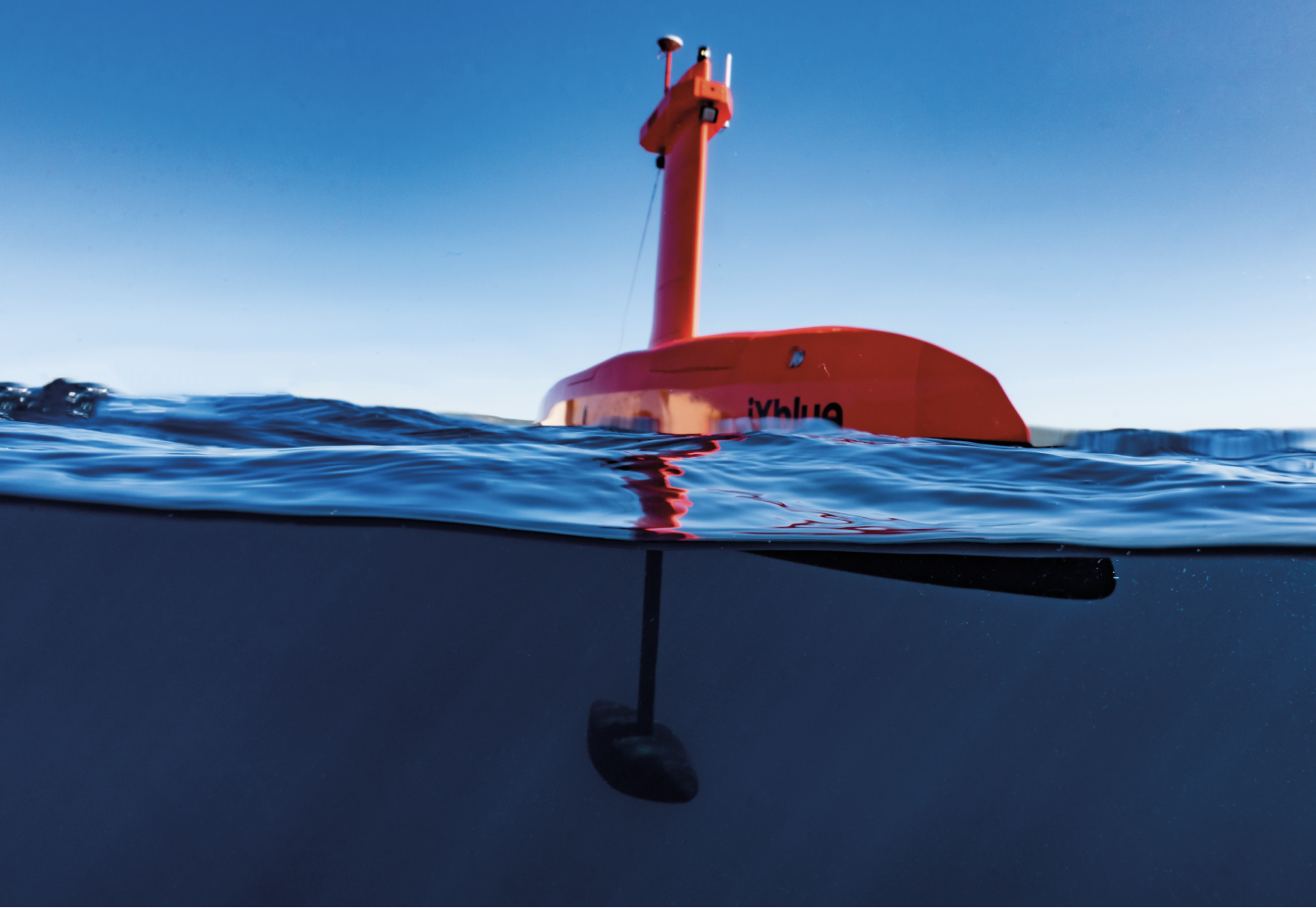
After a one-week transit from New Zealand, DriX USV and its 30 meters mothership – MV Silent Wings -, arrived on site, ready to survey the estimated 5,000nm required to complete the survey. A Multibeam Echosounder (MBES) and iXblue’s Phins Inertial Navigation System (INS) were both fitted onto DriX’ gondola, approximately 2 meters below the surface in optimum acoustic conditions for accurate and reliable data gathering.
Featuring an acoustically quiet hull form and unrivalled seakeeping capabilities, DriX was able to collect high quality bathymetry at high survey speeds of up to 10 knots. The 8-meter long USV proved to be able to survey in the same wind and sea conditions as the 30m mothership and often achieved in excess of 170nm per day. Together, DriX and the Silent Wings collected over 5,300nm of sounding data in a five-week period only.
For this mission, four iXblue survey personnel worked in shifts around the clock to operate DriX and the mothership survey system in order to ensure that the data collected was of a high quality. The survey fieldwork was then finalized with the recovery of all tidal sensors as well as the collection video imagery and seabed sampling across the survey area.
“We are very pleased with the survey results and are highly confident that the multi-sensor approach has exceeded all expectations of our client – LINZ. Their decision to award a project of this scale which utilises SDB, ALB and a USV fitted with MBES, has proven very successful. We are confident that this approach to undertake the large area survey of the PRNI Project will pave the way for many similar projects in this region in the coming years” David Donohue concludes. “the use of DriX was the first time that an unmanned surface vessel had been used for a contract hydrographic survey in the Southern Hemisphere. It was also the first time that iXblue had employed an USV on any survey project and it certainly proved to be a very successful test on its first outing. Our entire team was pleasantly surprised by the ease at which DriX could be deployed and operated as a force multiplier from the mother vessel. The data quality, safety, efficiency and cost effectiveness that the DriX now offers us is very exciting. There is no doubt that this vessel will change the way that large area surveys are undertaken in the future. It has proven the utility of USVs and will certainly encourage their use by other companies and organisations in the future”.